This week’s photo was taken on the Québec side of the Ottawa River, just across from Pembroke, Ontario, Canada in August 2020.
This picture was the result of a spur of the moment 4-hour road-trip I decided to take one early morning before work. (A story for another time) I’ve always known that the Ottawa River was wide, but when I arrived I was still surprised to find out just how big it actually was; it felt more like I was on the edge of a lake than on the banks of a river! While I only stayed for a few minutes before turning around to head back, it made for a nice day trip, and a good distraction from work for the time being.
See you next week!
The Ottawa River, Québec, Canada (ca. August 2020)
Thank you so much for reading, and if you’ve made it this far please consider liking the post, sharing it with your friends, and hitting the follow button so you don’t miss any of my upcoming material!And don’t forget to follow me on Instagram, Facebook, Twitter, and Pinterest!
Enter your email address below to subscribe and stay up-to-date on my latest posts!
Join 232 other subscribers
Looking to start a blog? Earn a $25 credit towards a wordpress.com plan when you sign up using the affiliate link below!
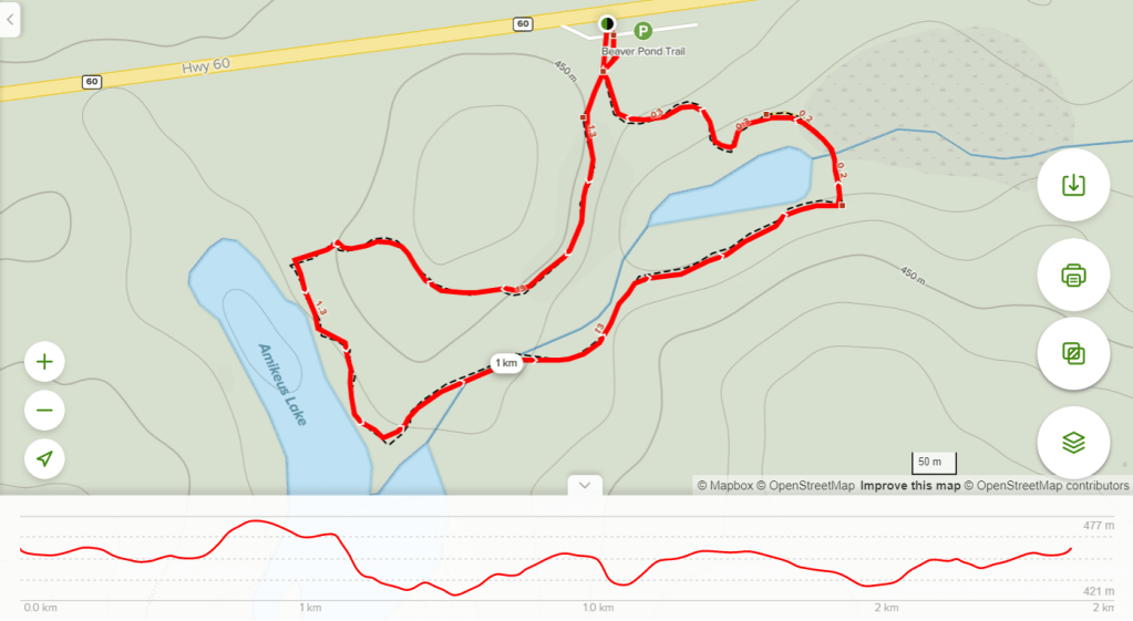
Location: Km marker 45.2, Highway 60, Algonquin Provincial Park, Ontario, Canada
Length: 2.0 km (1.2 mi)
Difficulty: Moderate
Features &Points of Interest: Beaver ponds, lodges & dams; scenic lookout.
Beaver Pond Trail Map – Algonquin Provincial Park (Source: alltrails.com)
Overview:
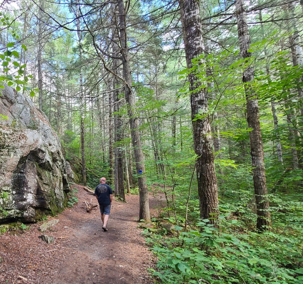
The Beaver Pond Trail is a 2.0 km (1.2 mi) hiking loop located in Algonquin Provincial Park, Ontario, Canada. The moderate-difficulty route features an array of beaver activity such as ponds, dams, and lodges, and navigates through several terrains including a bog, a forest, and a scenic rocky lookout. The Beaver PondTrail is perfect for those looking to explore multiple ecosystems within a relatively short distance, and learn about the impact beavers have on this stunning environment; all while still working up a good sweat.
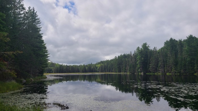
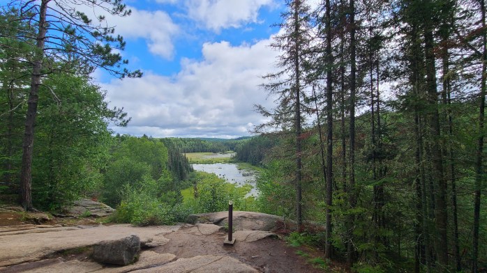
The Beaver Pond Trail begins with a walk across a bog on a well-maintained boardwalk.The contrasting wetland and forest environments are showcased throughout the hike.There is a helpful guidebook at the trailhead which explains how the beavers work to shape their surroundings.
Advertisements
Advertisements
What do you need to know?:
I highly recommend picking up aBeaver Pond Trail guidebook when you arrive at the trailhead. You can purchase one by leaving the correct change in the honour box below the trail map sign, or you can simply borrow it for free by returning it at the end of your hike. This guidebook provides insight into the dual history this area, and the beavers who live in it, and discusses the processes by which they have created and molded this environment to suit their survival needs. Just be on the lookout for the corresponding numbered fenceposts along the path, and refer to guidebook as you go.
On arrival, there is a sizeable parking lot available just off of highway 60. While crowds on this trail are generally less in number compared to other hikes such as The Lookout Trail, it is always worth keeping in mind the time of year you’re visiting (fall colours season will be busy) in order to enjoy the best experience. If you’re looking for another activity to pair with this hike, the Beaver Pond Trail is only 2 km (1.2 mi) away from theAlgonquin Park Visitors Centre.
If you’re thinking of hiking the Beaver Pond Trail, be sure to check the weather forecast in advance as the path is known to become a slush of mud after a good rainfall. If you find that the trail is in an unusable condition when you arrive, consider hiking the nearby Spruce Bog Boardwalk Trail to stay out of the muck and to keep your socks dry.
This beaver dam is an impressive example of the influence the beavers have.There are lots of opportunities to stop, take photos, and admire nature.The pinnacle of this hike is the scenic rock outcrop which overlooks one of the two beaver ponds.
Advertisements
Advertisements
How to get here:
From Toronto:
Hwy 400 –> Hwy 11 –> Hwy 60 –> Algonquin Park West Gate –> Km marker 45.2
*Be sure to stop in at the West Gate first to pick up your day pass*
Thank you so much for reading, and if you’ve made it this far please consider liking the post, sharing it with your friends, and hitting the follow button so you don’t miss any of my upcoming material!And don’t forget to follow me on Instagram, Facebook, Twitter, and Pinterest!
Enter your email address below tosubscribe and stay up-to-date on my latest posts!
Join 232 other subscribers
Looking to start a blog?Earn a $25 credit towards a wordpress.com plan when you sign up using the affiliate link below!
Today’s photo was taken back in September of 2020 in the Algonquin Highlands, located in Ontario, Canada.
I’m not really a morning person, but this past summer I found myself needing to wake up early for work and thankfully for my troubles, almost every day I was rewarded with an absolutely stunning sunrise. The lake, the big skies, the rolling forested hills, and of course the vibrant colours brought by the rising sun made this the perfect setting to start my day.
I miss these early mornings, and I can’t wait until winter finally releases its grip on the north, and I get to be here again. This picture below was la crème de la crème of all the sunrises I witnessed, and I’m sure you’ll see why.
See you next week!
Thank you so much for reading, and if you’ve made it this far please consider liking the post, sharing it with your friends, and hitting the follow button so you don’t miss any of my upcoming material!And don’t forget to follow me on Instagram, Facebook, Twitter, and Pinterest!
Enter your email address below to stay up-to-date on my latest posts!
Join 232 other subscribers
Looking to start a blog? Earn a $25 credit towards a wordpress.com plan when you sign up using the affiliate link below!
Location: Km marker 42.5, Highway 60, Algonquin Provincial Park, Ontario, Canada
Length: 1.4 km (0.87 mi)
Difficulty: Easy
Features &Points of Interest: Well maintained boardwalk, bird-watching, northern spruce bog, forested path, wheelchair accessible & kid friendly.
Spruce Bog Boardwalk Trail Map – Algonquin Park (Source: alltrails.com)
Overview
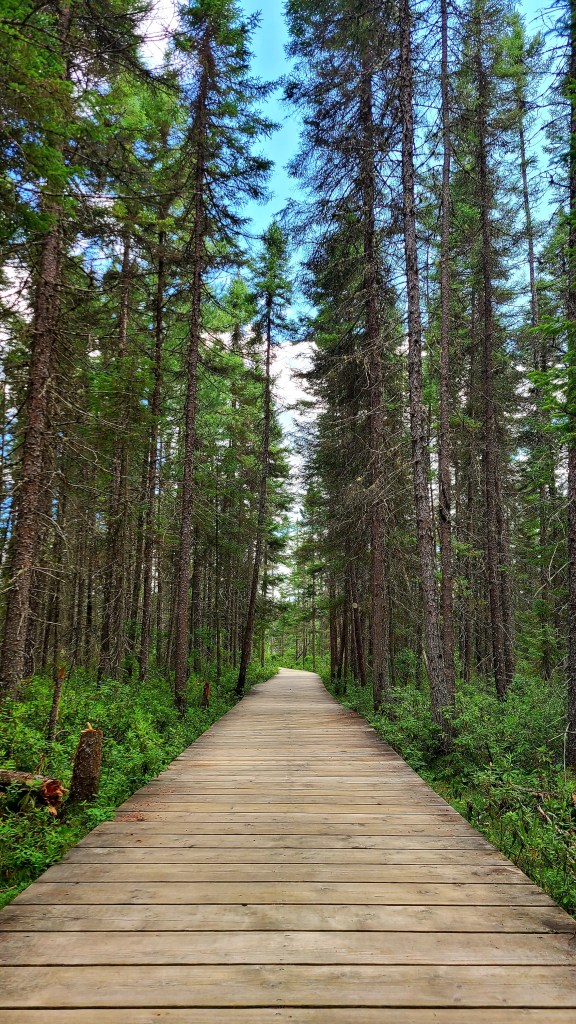
The Spruce Bog Boardwalk Trail, located in Algonquin Provincial Park, is an easy, wheelchair accessible 1.4 km (0.87 mi) loop that follows a well maintained wooden boardwalk through a northern spruce bog and wooded area. This trail provides excellent opportunities for bird-watching and photography, and is the perfect place to enjoy a slow paced nature walk with younger children and seniors.
The beginning of the trail hovers above the bog
A small stream runs through the heart of the bogAbout halfway through the trail, the boardwalk gives way to a forested path
Advertisements
Advertisements
What do you need to know?
The Spruce Bog Boardwalk Trail is one of the most accessible in all of Algonquin Park. While adventure seekers might prefer hiking somewhere else, this trail is a perfect place to go for a slow paced nature walk, take some photos, and enjoy the scenery with friends and family. The mostly flat grade, and relatively short length makes this a great choice for beginners, seniors, or those with younger children.
While the trail’s location is fairly far along the Highway 60 corridor, and a little ways away from the west entrance of AlgonquinPark, the Spruce Bog Boardwalk Trail is well worth the trip, especially as a companion activity to theVisitors Centre, located half a kilometre away at km 43.
In my opinion, this trail is best enjoyed if used from late June until late October to avoid the swarms of bugs you’ll encounter during blackfly season earlier in the spring. However, as this is the perfect spawning ground for mosquitos, you might want to choose a warm, sunny day to hike this trail in order to avoid getting bitten throughout the rest of the summer months!
Birds, turtles, beavers, and more can be found on this trail!This section of the trail, which snakes through a grouping of spruce trees, is perhaps the most photogenicWhile it’s scenic, beware, this is the perfect spawning ground for Mosquitos!
Advertisements
Advertisements
How to get here:
From Toronto:
Hwy 400 –> Hwy 11 –> Hwy 60 –> Algonquin Park West Gate –> Km marker 42.5
*Be sure to stop in at the West Gate first to pick up your day pass*
Thank you so much for reading, and if you’ve made it this far please consider liking the post, sharing it with your friends, and hitting the follow button so you don’t miss any of my upcoming material!And don’t forget to follow me on Instagram, Facebook, Twitter, and Pinterest!
Enter your email address below to stay up-to-date on my latest posts!
Join 232 other subscribers
Looking to start a blog? Earn a $25 credit towards a wordpress.com plan when you sign up using the affiliate link below!
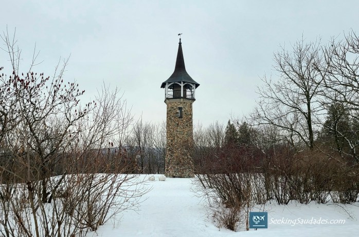
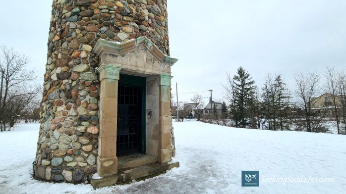
The Waterloo Pioneers Memorial Tower is an 18.9 m (62 ft.) tall stone tower constructed in 1925 to commemorate the original Pennsylvanian-German pioneer settlers who arrived in what is now Waterloo Region between 1800 and 1803. It is located along the banks of the Grand River in Kitchener, Ontario, Canada, just over a 1-hour drive from Toronto, and lies on what was originally the territory of the Six Nationsof the Grand River.
Features &Points of Interest: Stone tower, scenic lookout, historical sites, natural area, hiking trails, community park.
Advertisements
Advertisements
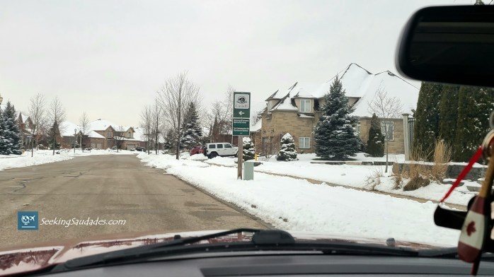
Although the Waterloo Pioneers Memorial Tower used to be surrounded by farmers fields and forests, the structure now lies at the back of a recently constructed subdivision. To get to the tower, simply follow the Parks Canada signs that begin to appear once you turn off of King St. and onto Deer Ridge Rd. On arrival, there is a small, and free parking lot available.
Parks Canada directions sign
Waterloo Pioneers Memorial Tower parking lot
Waterloo Pioneers Memorial Tower
The tower is located within steps to the parking lot, and sits in the centre of a small clearing. At the site, there are a couple of informational plaques that recount the history of the area, and the historical significance of tower itself, of which I will briefly cover before continuing on to what else this destination has to offer.
Advertisements
Advertisements
Parks Canada historical plaque
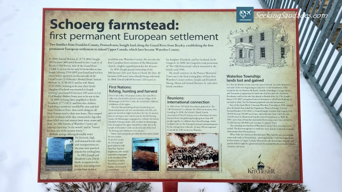
In 1784, nearly 240,000 hectares of land, including that of which the Waterloo Pioneers Memorial Tower now sits on, was given as a gift to the Six Nations Confederacy for their allegiance and support to the British Crown during the American Revolutionary War. In the years to come, some 38,000 hectares of this land was then purchased and sold again, this time by German Mennonite Settlers from Pennsylvania, who were looking to escape the persecution and high land prices they faced in the United States.
As time passed, more and more German pioneer settlers travelled to what would eventually become Waterloo County. They established homesteads and farms, and began cultivating and developing the land; the first of which was located on this site, where the Waterloo Pioneers Memorial Tower now lies, in present day Kitchener, Ontario.
While today the city is known as Kitchener, Ontario, this wasn’t always the case. In the past, the city went by a different name; Berlin, Ontario. Beginning with the arrival of the original German Pioneer settlers, who established Berlin in the early 1800s, this area has maintained a prominent German cultural presence. Even today, the largest Oktoberfest outside of Germany takes place here every year, attracting over 700,000 visitors annually.
However, in 1916 this heritage wasn’t as keenly celebrated. In response to the growing local anti-German sentiments caused by the outbreak of World War I, the city voted to change its name in support of the British Empire, and thus was renamed to Kitchener, Ontario, after Herbert Kitchener, a prominent Irish-born officer who served in the British Army from 1871 to 1916.
Following the conclusion of the first world war, to make amends for the damage done by the anti-German sentiments, and subsequent city name change, a petition was put forth to the local government to construct a monument to represent the historical significance of the original pioneer settlers, and German heritage. Thus, the Waterloo Pioneers Memorial Tower was built. It cost $4,500 to build, and was eventually designated as a historical site in 1989. While there have been some refurbishments to the original structure over the years, its exterior appearance has remained relatively unchanged since.
Advertisements
Advertisements
While at one point the interior of the tower was open to the public, today the front entrance is locked. However, if you’re interested in seeing the inside, you can contact Parks Canada ahead of time to gain access and schedule an official tour.
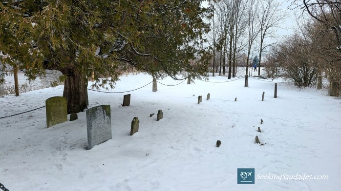
Nearby the tower there is also a small cemetery, inside of which you’ll find the headstones of some of those original German pioneers, including Joseph and Elizabeth Sherk, parents of David Sherk, who is reputed to be the first non-indigenous person born in what would become Waterloo County.
Dedication Plaque located on the side of the tower
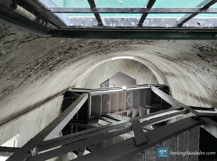
Inner staircase leading to the top of the tower
Nearby pioneer cemetery
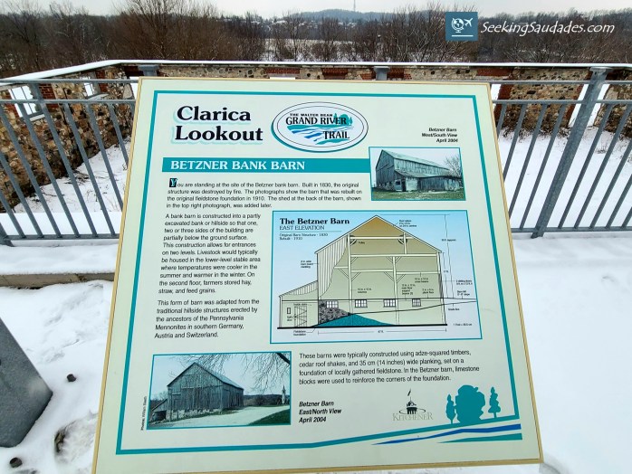
When you’re finished taking in the Waterloo Pioneers Memorial Tower, I recommend going for a short walk down Joseph Schoerg Crescent to explore the ruins of the Betzner Barn, and the Schoerg (Sherk) farmstead, the first permanent European settlement in inland Upper Canada. There are also several informational plaques which talk about the the history of the pioneers, and the local area which I described above.
The remaining structure of the Betzner barn
Joseph Schoerg Crescent (ruins at left, tower down the road)
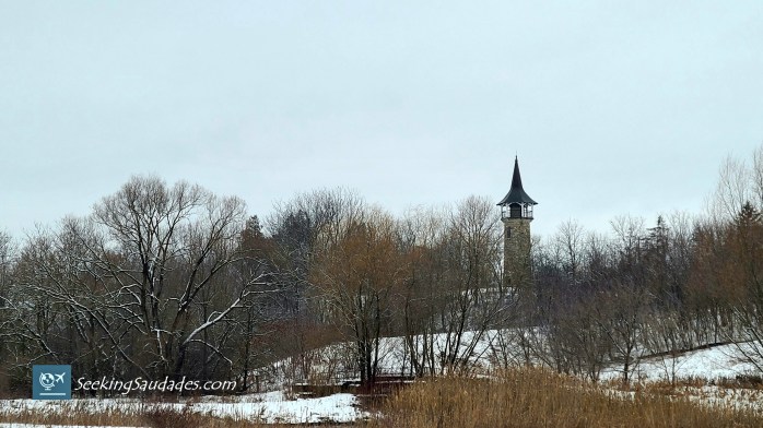
The Betzner Barn is also the location of Clarica Lookout, which offers a view of the nearby Pioneer Tower Natural Area. This greenspace was created to protect the winter habitat of the king of the skies, the Bald Eagle. Since the 1700s, the local population of this majestic bird has been decimated due to hunting and habitat loss, and so this natural area remains one of the few refuges in the region.
The view from Clarica Lookout
Advertisements
Advertisements
While the Waterloo Pioneers Memorial Tower and surrounding structures offer a glimpse back into history, this area also features Kuntz Park, the Walter Bean Grand River Trail, and the Pioneer Tower Natural Area, as I mentioned above. These locations are great places to go for a nature walk, and while I only had time to walk the Pioneer Tower Natural Area section of the trail, there are more than 17 km (10.5 mi) of pathways to explore, stretching all the way from Cambridge, Ontario, through the City of Kitchener along the Grand River, and then further more on to Waterloo, Ontario.
Walter Bean Grand River Trail Map
Path leading into the Pioneer Tower Natural Area
The Waterloo Pioneers Memorial Tower, in combination with the Pioneer Tower Natural Area, and the Walter Bean Grand River Trail makes this destination well worth the visit. Whether it be the history, the nature, or simply being a great place to go for a walk, there is something here for everyone to enjoy.
Thank you so much for reading, and if you’ve made it this far please consider liking the post, sharing it with your friends, and hitting the follow button so you don’t miss any of my upcoming material!And don’t forget to follow me on Instagram, Facebook, Twitter, and Pinterest!
Enter your email address below to stay up-to-date on my latest posts!
Join 232 other subscribers
Looking to start a blog? Earn a $25 credit towards a wordpress.com plan when you sign up using the affiliate link below!
The Lookout Trail, located in Algonquin Provincial Park, is a moderate to difficult 2.1 km loop that features a sweeping scenic lookout, large rock outcrop, and well-maintained forested path. Despite its relatively short length, this trail can pose a challenge for some due to its steep incline, and elevation gain. At a moderate pace, the hike can be completed in less than 1 hour.
Flat, forested section of the path, just past the trailhead
Shortly past this point, the trail gives way to a relatively steepincline
Advertisements
Advertisements
What do you need to know?
Hikers will be rewarded with one of the best views in the entire area and a fantastic place to stop, catch your breath, and take an unhealthy amount of photos. Just be warned though, this trail is one of the most accessible in Algonquin Park, and as such will be one of the busiest. It’s best to hike the Lookout Trail earlier in the morning, or later in the afternoon to avoid the lunchtime and evening rushes.
If you’re planning on visiting during the Fall colours season, particularly on the weekend, know that the parking lot reaches over-capacity quickly, and the path becomes nearly unusable due to the congestion. To maximize your enjoyment, consider coming during the week, or visiting the park at a time of year when the crowds aren’t as numerous.
A bench at the top is the perfect place rest, or take photosA small lake is visible in the distance
Advertisements
Advertisements
How to get here:
From Toronto:
Hwy 400 –> Hwy 11 –> Hwy 60 –> Algonquin Park West Gate –> km marker 39.7
*Be sure to stop in at the West Gate to pick up your day pass*
Thank you so much for reading, and if you’ve made it this far please consider liking the post, sharing it with your friends, and hitting the follow button so you don’t miss any of my upcoming material!And don’t forget to follow me on Instagram, Facebook, Twitter, and Pinterest!
Enter your email address below to stay up-to-date on my latest posts!
Join 232 other subscribers
Looking to start a blog? Earn a $25 credit towards a wordpress.com plan when you sign up using the affiliate link below!
Welcome back to Photo Friday, and Merry Christmas!
This week I’ve chosen a picture that was taken from an unmarked trail and lookout in the Algonquin Highlands, located just south of Algonquin Provincial Parkin central Ontario, Canada in July of 2020.
For those looking to get out and explore next year, this region of Ontario offers some of the best hiking, swimming, camping, sight seeing, boating and more in the entire province. The best part: it’s within close proximity to Toronto, about a 3 hour drive, so you can easily make a day trip out of it. This area is one of my favourite places on Earth, and the photo below might just help illustrate why.
See you next week!
Algonquin Highlands, Ontario, Canada (ca. July 2020)
Thank you so much for reading, and if you’ve made it this far please consider liking the post, sharing it with your friends, and hitting the follow button so you don’t miss any of my upcoming material!And don’t forget to follow me on Instagram, Facebook, Twitter, and Pinterest!
Enter your email address below to subscribe and stay up-to-date on my latest posts!
Join 232 other subscribers
Looking to start a blog?Earn a $25 credit towards a wordpress.com plan when you sign up using the affiliate link below!
*This article was originally posted on September 21st, 2020 and has since been restructured, edited, and reposted to provide a more enjoyable and informative readingexperience.*
In September of 2020, I went on a road trip to Manitoulin Island, and decided to car camp at Chutes Provincial Park in Massey, Ontario, Canadafor 2 nights. Here are some photo highlights of the stay, and why everyone should make time to explore this small, yet picturesque park.
The entrance to Chutes Provincial Park is tucked just off of the Trans-Canada Highway, making it an easy stopping off point while driving in-between Sudbury and Sault Ste. Marie.
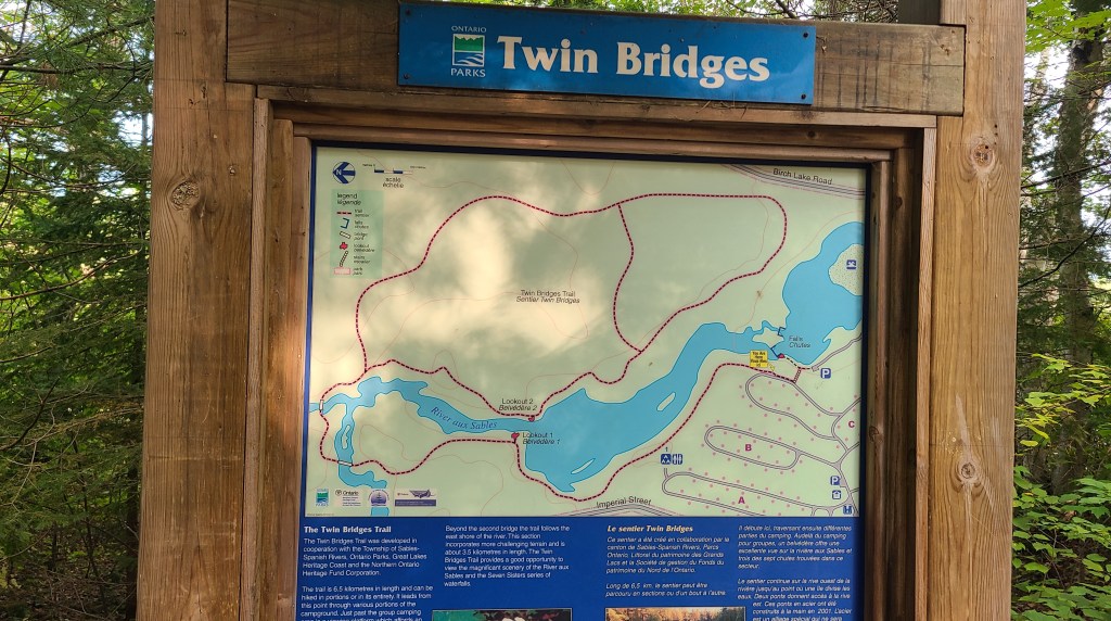
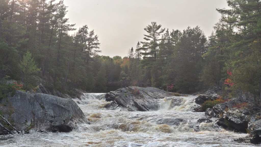
Chutes Provincial Park is named for its’ logging history along the Aux Sables River. Every Campsite is within close walking distance to the river, and the roar of the waterfall echoes in the distance.
The only comfort station is in a central location to all of the campsites and was always very clean. There are plenty of privies scattered along the camp roads if you don’t want to go too far in the middle of the night. They are in some of the best condition I’ve seen in an Ontario park!
My campsite was located on Big Chute Crescent, which is accessed via Log Drive Lane, just past the comfort station.
Campsite #98. My home for the next 2 nights. Well treed for lots of privacy, 2 picnic tables, and only a short walk to the falls and the Twin Bridges Trail. There are privies just down the road, and a water tap is located right next door. In my opinion, this section of Chutes Provincial Park (which happens to be a radio free zone) offers the best sites for car camping.
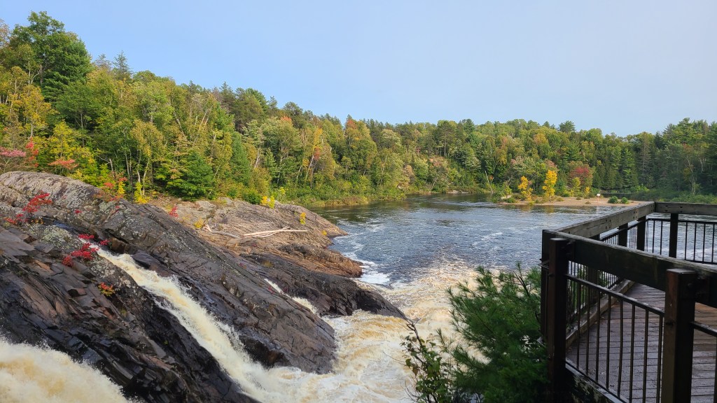
The park’s main observation deck hangs just next to the Falls and offers a great place to first get acquainted with the scenery when you arrive.
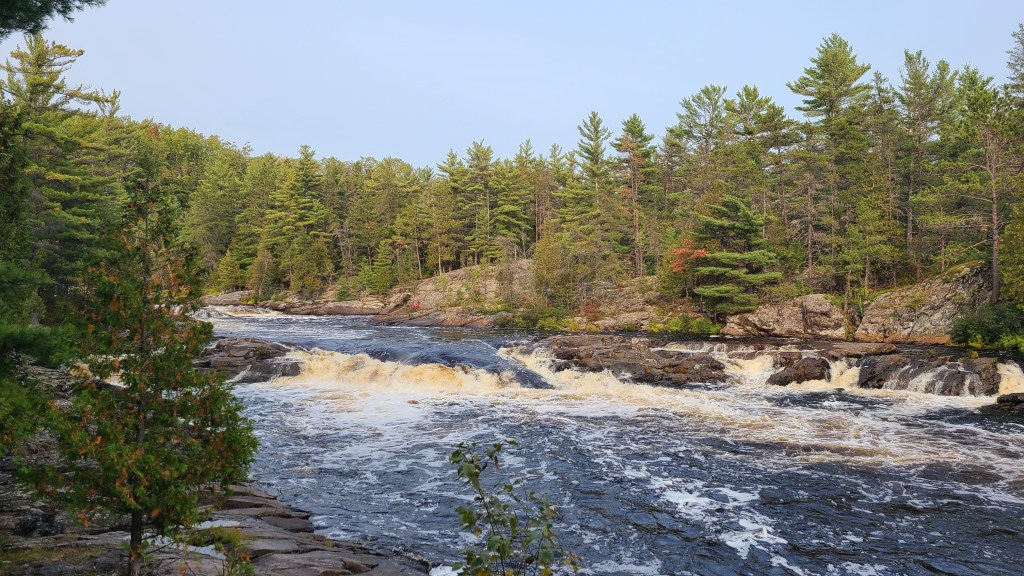
The main falls are an awe-inspiring sight, and a short walk from anywhere in the park.
Advertisements
Advertisements
The main falls, and the day use beach in the distance.
The day use beach area is only a short walk from the falls, and makes for a great place to have a picnic by the water.
Although the Park only has one walking trail, it is well worth the stop. It offers stunning views, rocky terrain, and a taste of the untamed northern wilderness. There are plenty of places to stop and take pictures, and the trail is never overly busy with other hikers. The walking is fairly easy as well, so anyone can take part.
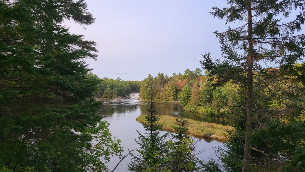
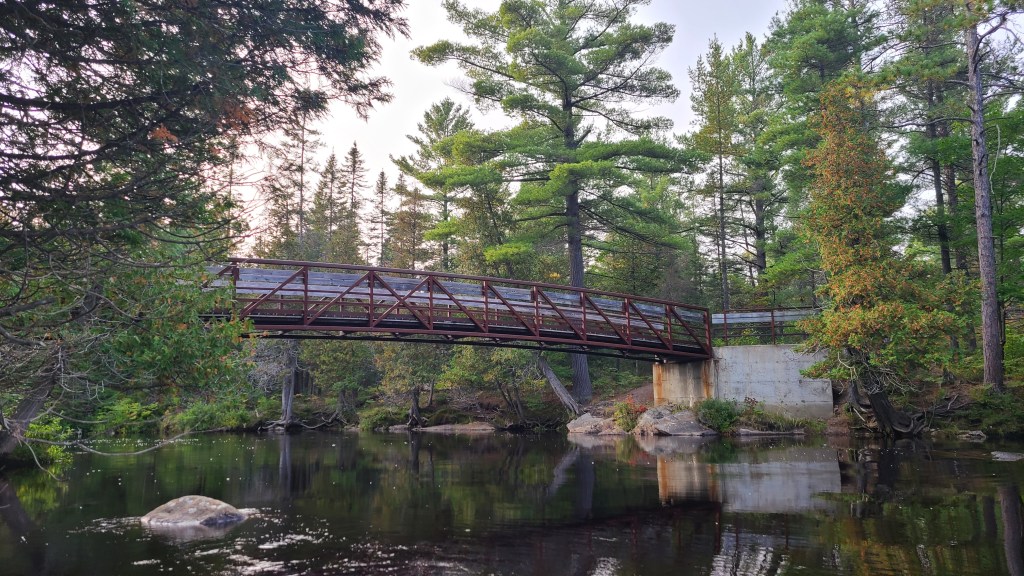
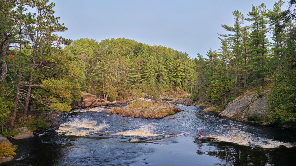
The Twin Bridges trail follows the banks of the Aux Sables River, offering plenty of photo opportunities at every turn. The pictures that follow showcase just a few of the many sights to be seen.
Calmer sections of the river provide a brief and quiet moment of refuge from the raging torrents of the rapids soon to come.
Perhaps the most stunning part of the trail, the convergence of the two halves of the river lead into the Seven Sisters Rapids. The raw strength of the flowing water is an impressive sight.
The trail past this point continues further into the woods, but the hike up to here is well worth it on its own!
I highly recommend staying at Chutes Provincial Park. The staff are friendly, the campsites are well tended to, and the location and scenery are hard to beat! If you have any questions, feel free to leave me a comment below and I’ll do my best to answer.
Thank you so much for reading, and if you’ve made it this far please consider liking the post, sharing it with your friends, and hitting the follow button so you don’t miss any of my upcoming material!And don’t forget to follow me on Instagram, Facebook, Twitter, and Pinterest!
Enter your email address below to subscribe and stay up-to-date on my latest posts!
Join 232 other subscribers
Looking to start a blog?Earn a $25 credit towards a wordpress.com plan when you sign up using the affiliate link below!
In Canada, specifically in the southern portion of the province of Ontario, we’re not exactly in the running for the “most creative city names” award. It seems like almost every place is named after somewhere else, and this has led to some interesting conversations whenever I’ve gotten back from travelling somewhere abroad.
When I was in elementary school, my family went on a trip to London, England and Paris, France. I was in grade 2, and was about to turn 7 years old. My dad had scrounged together enough frequent flyer miles from travelling for work to take the family on vacation. It would be my first trip to Europe, and as far as I’m aware, I was the only kid in my class who had travelled overseas. So when I got back from the trip and was talking to my classmates about where I went, there was some initial confusion.
See, there are two Ontario towns not too far from each other that are named London, and Paris. So to everyone else it wasn’t exactly an impressive feat heading for a short drive down the highway. It took a while but eventually I managed to convince them that I had been to the Real London and Paris out there way across the Atlantic Ocean. There have been a few examples of this throughout my life, and every time I can’t help but wish those early settlers had come up with some original names, or better yet just used the Indigenous names that had already been given to those areas.
However, this lack of creativity means that you are able to travel to a multitude of “European” cities over a small part of just one day. In a mere 4 hours, and 300 km you can visit Paris, Vienna, Copenhagen, London, Dublin, Brussels and Lisbon! All without buying a single plane ticket; talk about bang for your buck.
Check it out on the map below:
This road trip is definitely on my radar come 2021, and I’ll be sure to document my “European” adventure when the time comes. While these are mostly small towns surrounded by nothing but boring roads and farmland, doing it for the sake of doing it is really all the convincing I need.
Thank you so much for reading, and if you’ve made it this far please consider liking the post, sharing it with your friends, and hitting the follow button so you don’t miss any of my upcoming material!And don’t forget to follow me on Instagram, Facebook, Twitter, and Pinterest!
Enter your email address below to subscribe and stay up-to-date on my latest posts!
Join 232 other subscribers
Looking to start a blog?Earn a $25 credit towards a wordpress.com plan when you sign up using the affiliate link below!
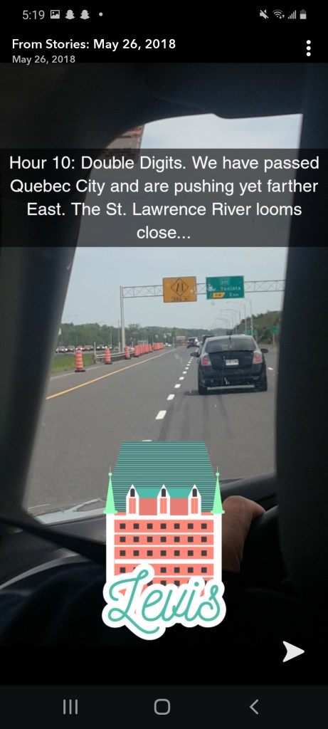
In May of 2018, I was invited on a 17-hour, 1500 km road trip from southern Ontario to Beresford, New Brunswick with my friend Sam and his family. In order to help pass the time, and in an effort to remember the experience I posted a story on my snapchat account every hour of the car ride, plus a little extra. What follows are the pictures documenting the journey:
We had to leave bright and early in the morning in order to make it in time for dinner later that day. The 3:30 a.m. wake up call also insured we would be driving through the dense forests of New Brunswick in the day-light. Crucial in avoiding a deadly collision with a Moose.
If you’ve ever driven through Toronto, you would understand the extra benefit of driving through the city in the middle of the night. Highway 401, which runs right through the heart of the city is the busiest highway in all of North America, carrying upwards of half a million people per day. No traffic meant we saved upwards of an hour and a half on our trip.
At this point we had been driving for quite a while, and seeing as none of us had eaten yet, Tim Horton’s was always going to be our first stop. Double Doubles, Timbits, and some bacon breakfast sandwiches were just what we needed.
Advertisements
Advertisements
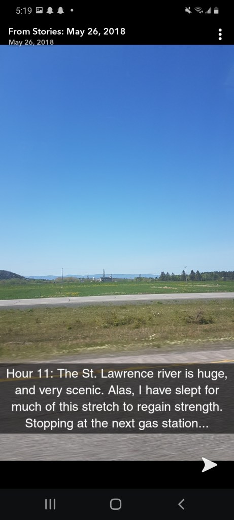
After picking up refreshments, we got back on the road. Now, if you’re not from Canada then it’s important to know that we tend to make fun of the French province of Quebec. The English – French rivalry in Canada has it’s roots in the formation of the country, which was dominated by settlers from the United Kingdom, and France battling for control of the land surrounding the St. Lawrence river, and the fertile great lakes region.
The closer we got to Quebec, the more vocal my jabs at the French became. The only problem – Sam and his family have French heritage (hence the road trip to partly French New Brunswick) so they were having none of it. It was all in fun, but deep down I knew it ever so slightly got to them. Thus, in order to prevent a civil war in the car, some ground rules had to be established:
There shall be no French slander of any kind; and
If said rule is broken I will be spending the remaining 10 hours of the drive sitting in the trunk.
We continued.
For those that don’t know, Canada is a bilingual nation. This means that our two official languages are French and English. The school system is mandated to teach both, but this doesn’t mean they do a good job.
This trip was the first time that I had been to another Canadian province other than my home of Ontario. It was a long time in the making, and I thought Quebec and New Brunswick were well worth the wait.
Advertisements
Advertisements
Most of this trip was spent on the road in 5 hours blocks, and there was no exception to this rule. You had better use the washroom when we were filling up on gas because otherwise you’d be peeing in a water bottle in the backseat.
The legal drinking age in Quebec is 18 years old, which is one year lower than Ontario, so you better believe we took this opportunity to buy some beer. To our surprise, we didn’t get ID’d by the gas station attendant and made it out without issue. Don’t worry, we didn’t open the beverages until we got to our final destination. It was a well deserved cold one.
Advertisements
Advertisements
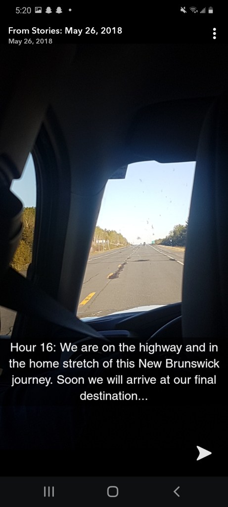
By this time in the road trip my brain had turned to mush, my legs were practically falling off, and we were all getting pretty irritable. Luckily we didn’t have relatively far left to go and so, we pushed on.
Advertisements
Advertisements
Let me tell you, when we finally pulled off the highway and saw our first glimpse of the Atlantic Ocean, well, that was a fantastic feeling. We were itching to get out of the car and be greeted by a nice home cooked meal, and a couple drinks by the fire.
Although long, the journey was well worth it. I was grateful to see more of my home country and gained a new appreciation for the diversity such a large nation offers. We stayed in New Brunswick for a week, before cramming in the back of the car for the 17-hour return journey.
Thank you so much for reading, and if you’ve made it this far please consider liking the post, sharing it with your friends, and hitting the follow button so you don’t miss any of my upcoming material!And don’t forget to follow me on Instagram, Facebook, Twitter, and Pinterest!
Enter your email address below to subscribe and stay up-to-date on my latest posts!
Join 232 other subscribers
Looking to start a blog?Earn a $25 credit towards a wordpress.com plan when you sign up using the affiliate link below!